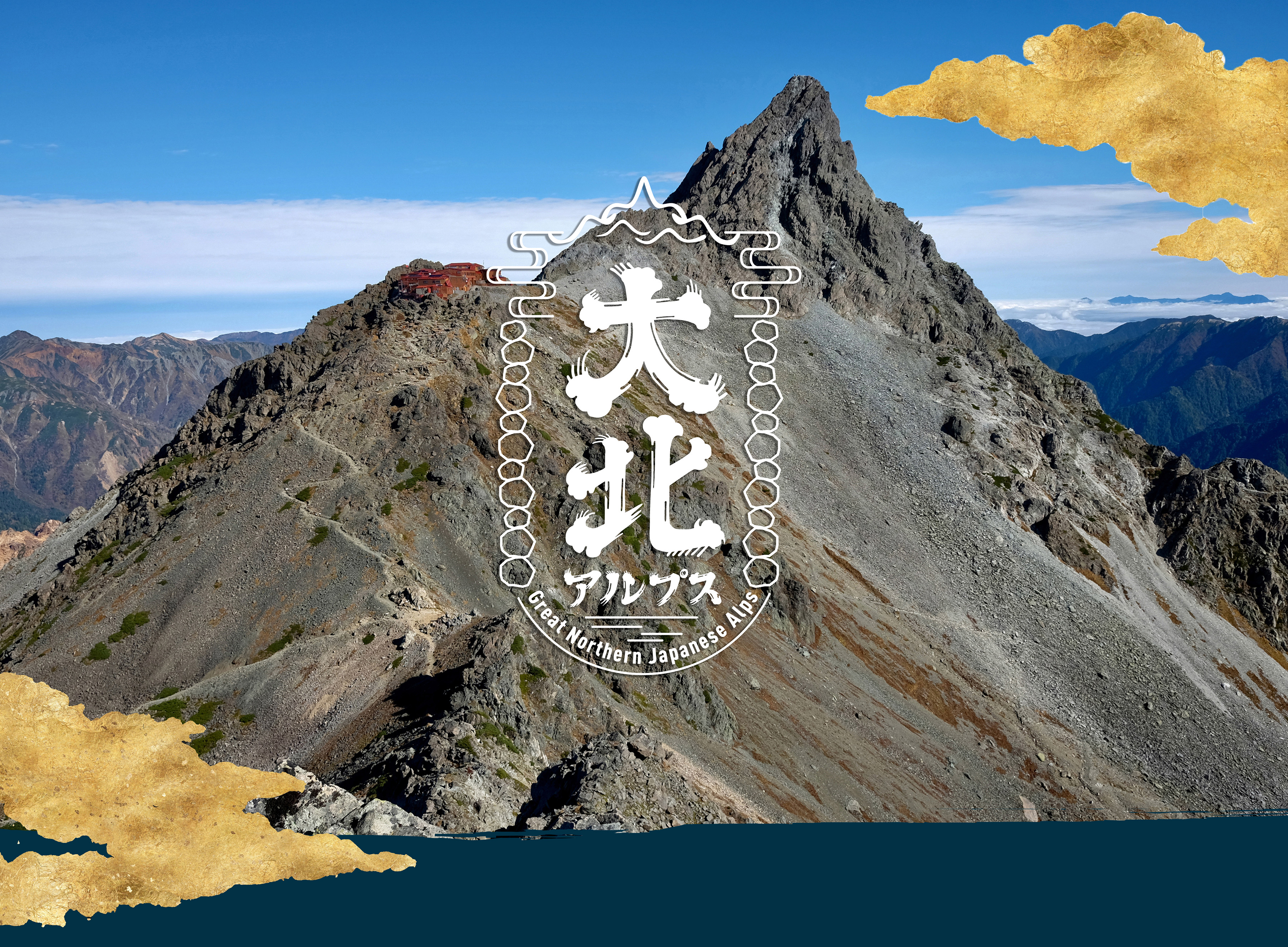
What is the Great Northern Japanese Alps?
The "Great Northern Japanese Alps" is a self-challenge event where participants aim to conquer all the famous peaks and 3000-meter mountains in the main area of the Northern Japanese Alps on their own.
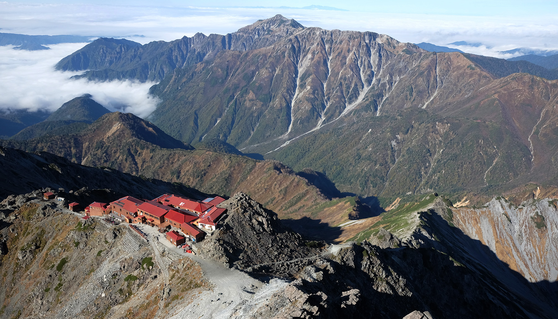
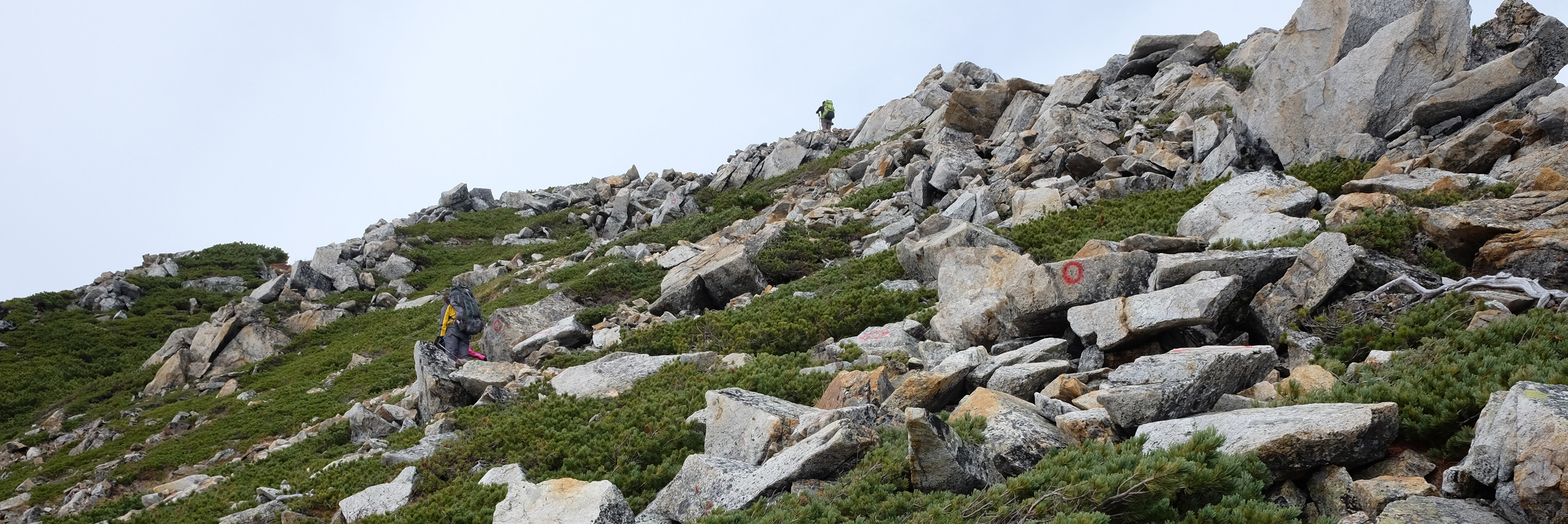
The Northern Alps (Hida Mountains) are home to a series of Japan's representative 3000-meter-class mountains. Upon reaching the ridgeline, you are greeted with breathtaking, otherworldly views. Together with the Central Alps (Kiso Mountains) and Southern Alps (Akaishi Mountains), they are known as the Japanese Alps. Among them, the Northern Alps boast a main ridgeline that spans over 200 kilometers, embodying the grandeur, beauty, and harshness that represent Japan's mountainous landscapes.
Currently, hosting large-scale events in national parks and special protected areas in Japan is challenging, limiting the opportunities for grand challenges in the beautiful mountainous landscapes represented by the Northern Alps. Therefore, we conceived an event where each participant can undertake the challenge at their own pace and responsibility, ensuring that "anyone who wants to, can definitely take on the challenge."
You can challenge yourself to see how quickly you can return or take your time to fully enjoy the mountains at your own pace. The style is entirely up to each participant.
Take on the grand course that might be difficult to tackle alone, supported by fellow event participants and supporters, and fully enjoy the grandeur, severity, and beauty of the Northern Alps.
GREAT NORTHERN JAPANESE ALPS 2026 Entry List
Upcoming Challenges
| # | No. | Photo | Name | Category | Planned Start |
|---|---|---|---|---|---|
| 1 | 1 |
野入久幸 NOIRI HISAYUKI |
No Resupply | 2026-07-31 06:00 | |
|
Course: これから考えます。上高地から Intro: 昨年からの留年です。今年の完走目指して頑張ります。
|
|||||
| 2 | 2 |
菅原幸彦 菅原幸彦 |
Hut Stay & Resupply | 2026-08-23 15:00 | |
|
Course: 白馬三山から長野県側を南下→焼岳から北上し富山県側を通って白馬へ Intro: ゆるっと安全第一で楽しみたいと思います!
|
|||||
| 3 | 3 |
キャスター ブライアン Caster Brian |
Hut Resupply | 2026-08-01 10:25 | |
|
Course: 白馬岳からか、上高地からか、考え中です。 Intro: 30のCPを一気に踏破するチャレンジをしたいと思います。
|
|||||
| 4 | 4 |
Andrew Statter Andrew Statter |
Hut Resupply | 2026-08-07 23:59 | |
|
Course: 上高地から Intro: 山が好きだから山登る
|
|||||
| 5 | 5 |
風澤央菜 HIRONA FUSAWA |
Hut Stay & Resupply | 2026-08-05 00:00 | |
|
Course: https://www.yamareco.com/modules/yr_plan/code-wtjSBFYtSnK_1YvNxgBd6g Intro: 夏の北アルプス大縦走今年で3年目になります。
「こんなのがあるよ」と大北を紹介していただいたのでチャレンジしてみようと思いました。
最後まで楽しんで安全に踏破できるよう準備していきます。
|
|||||
| 6 | 6 |
井寄慎 MAKOTO IYORI |
Hut Stay & Resupply | 2026-08-08 09:00 | |
|
Course: 大北2026_Day1-4 8/8 室堂スタート [経由地] 室堂山荘-一の越-雄山-大汝休憩場-真砂岳- 剱沢キャンプ場-剱沢小屋-平蔵谷出合-[泊地] 真砂沢ロッジ 到着 14時01分 day2 出発 05時00分 梯子段分岐-二股-仙人峠- 仙人池ヒュッテ- 仙人温泉小屋(休業中)-仙人ダム-人見平-阿曾原峠- [泊地] 阿曾温泉 到着 12時32分 day3 出発 03時00分 折尾谷-大太鼓-志合谷-水平道終点 -不帰避難小屋-清水岳-白馬山荘-白馬岳-白馬山荘-祖母谷分岐- [泊地] 村営頂上宿舎 到着 16時51分 day4 出発 06時00分 白馬尻小屋-御殿場- 鑓温泉分岐 下山口 長野県 猿倉荘2026年08月11日 08時39分 到着 電車で信濃大町へ Intro: 昨年からの留年組です。
今年度で残りをどこまで進むことが出来るか楽しみです。
|
|||||
| 7 | 7 |
碓井直樹 Naoki Usui |
Hut Resupply | 2026-07-11 00:00 | |
|
Course: これから考えます。たぶん、仲間の誰かと一緒にやります。 Intro: 今回はマイラーズ東海と関係なく、個人的にのんびりやろうと思っています。
暑いの苦手なので避暑も兼ねて高山に行きたい。
麓の温泉にゆっくり浸かりたい。
|
|||||
| 8 | 8 |
丸田友之 Tomoyuki Maruta |
Hut Resupply | 2026-07-25 00:00 | |
|
Course: 新穂高温泉を起点に大回りと小回りする予定です。関東から行きにくい立山方面を先に攻略したいと思っています。 Intro: 第一回から参加者のドットを追っかけつつ応援してきました。家庭や仕事の調整がついたので、今年こそはとチャレンジです。安全第一で楽しみます!
|
|||||


Event Period
Eligibility
- Those who have traversed ridgelines above 2500m for more than two consecutive days.
- Those who have the skills and physical strength to safely complete the course of this event.
- Those who have mountain insurance (including coverage for search and rescue costs).
Participation Fee
- For participants who already have an IBUKI device: 10,000 yen (tax included)
- For those without an IBUKI device: 15,000 yen (tax included)
Rules
- Start from a trailhead, visit all 30 checkpoints, connect the route between them on foot, and complete a loop returning to the start.
-
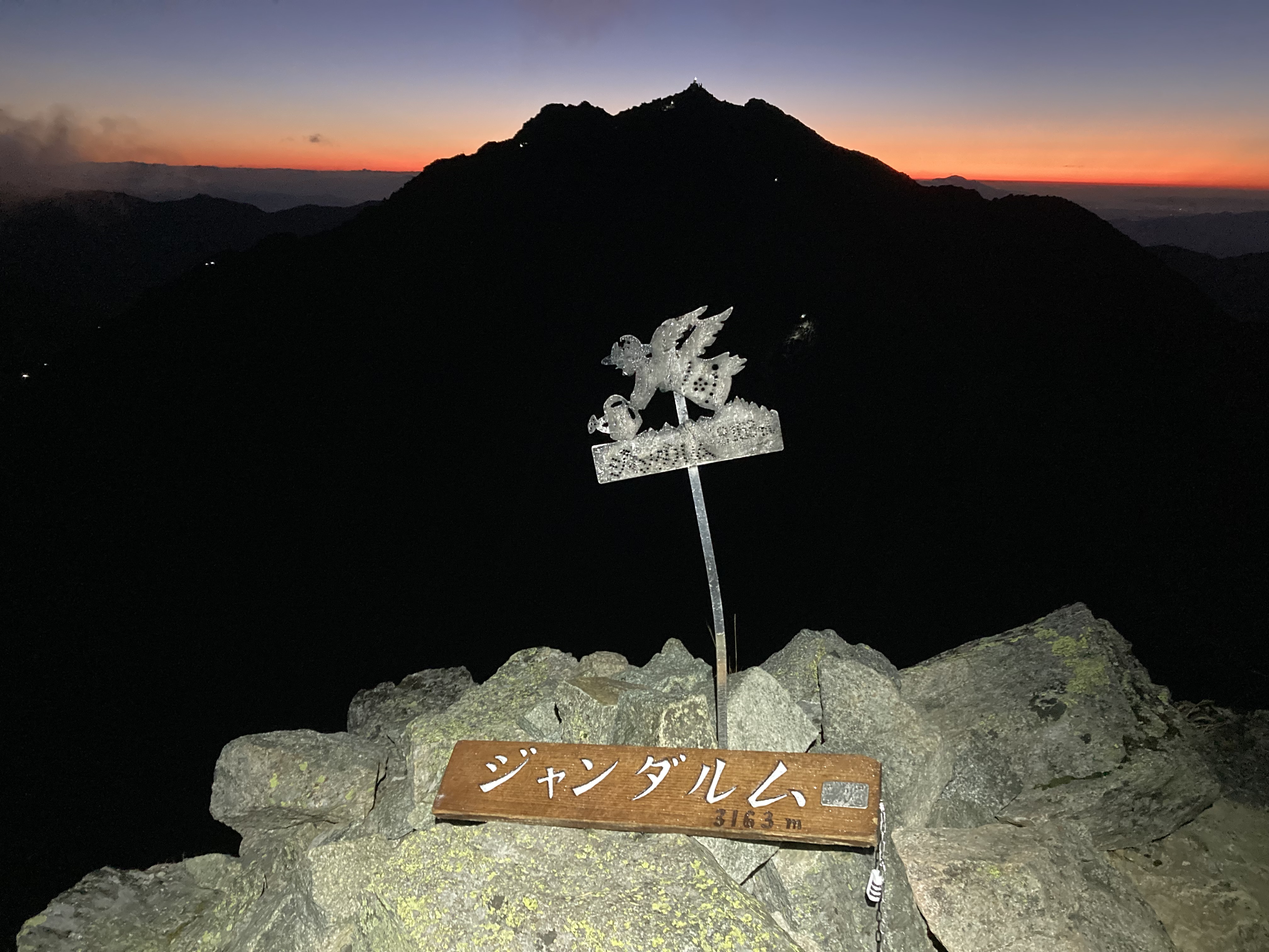
The checkpoints are as follows: a total of 30 points.
- Hundred Famous Mountains (in the order determined by Kyuya Fukada), 14 peaks: Mt. Shirouma (45), Mt. Goryu (46), Mt. Kashimayari (47), Mt. Tsurugi (48), Mt. Tateyama (Oonanjiyama) (49), Mt. Yakushi (50), Mt. Kurobegoro (51), Mt. Suisho (52), Mt. Washiba (53), Mt. Yari (54), Mt. Okuhotaka (55), Mt. Jounendake (56), Mt. Kasagatake (57), Mt. Yakedake (58)
- 3000-meter Peaks (in order of elevation, ☆ indicates overlap with Hundred Famous Mountains), 9 peaks (excluding 6 Hundred Famous Mountains): Mt. Okuhotaka☆ (3190m), Mt. Yari☆ (3180m), Mt. Karasawa (3110m), Mt. Kitahotaka (3106m), Mt. Obami (3101m), Mt. Maehotaka (3090m), Mt. Nakadake (3084m), Mt. Minamidake (3033m), Mt. Tateyama (Oonanjiyama)☆ (3015m)
- 200 Famous Mountains, 300 Famous Mountains, and event-designated mountains along the ridgeline routes (in model course order), 10 peaks: Mt. Sugoroku (event-designated), Mt. Mitsumatarenge (300 Famous Mountains), Mt. Karamatsu (300 Famous Mountains), Mt. Jii (300 Famous Mountains), Mt. Harinoki (200 Famous Mountains), Mt. Renge (300 Famous Mountains), Mt. Eboshi (200 Famous Mountains), Mt. Noguchi-Goro (300 Famous Mountains), Mt. Otenshou (200 Famous Mountains), Mt. Chou (event-designated)
- Due to the 2024 Noto Peninsula Earthquake, the Kurobe Gorge Railway (Unazuki-Nekomata) is suspended, and hikers were asked to avoid the trail between Mt. Shirouma/Karamatsu and Sobonotani. However, work is underway for a full reopening in 2026. Assuming restrictions are lifted, we have adopted the original 'loop' rule. If restrictions remain, the rule will revert to the 'point-to-point' format (non-loop) used last year. Please check the Kurobe Gorge Railway News Page for updates.
- As of February 9, 2026, Mt. Yakedake (58), one of the checkpoints, is at 'Volcanic Alert Level 2' and entry is prohibited. Regarding the summit hunt for Mt. Yakedake, 'approaching as close as possible within the allowable range at the time of the event will be considered as passing (in the case of Level 2, up to Kamikochi, Nakao Trailhead, or Nishiho Sanso junction).' For the latest information on regulations, please check the Japan Meteorological Agency's Activity Info.
- You can start whenever you like during the event period, but be sure to finish before it ends.
- Choose your start and finish point, direction, and route however you like as long as you follow the rules.
- Take a photo of yourself and a sign or landmark at every checkpoint and send us the link.
- Carry an IBUKI GPS device and share your track on the official page.
- We'll check your photos and logs to confirm you've hit every checkpoint and post your finish time in the rankings.
-
Pick a style below and let us know your category. You can change it later if needed, like when you have to stay in a hut.
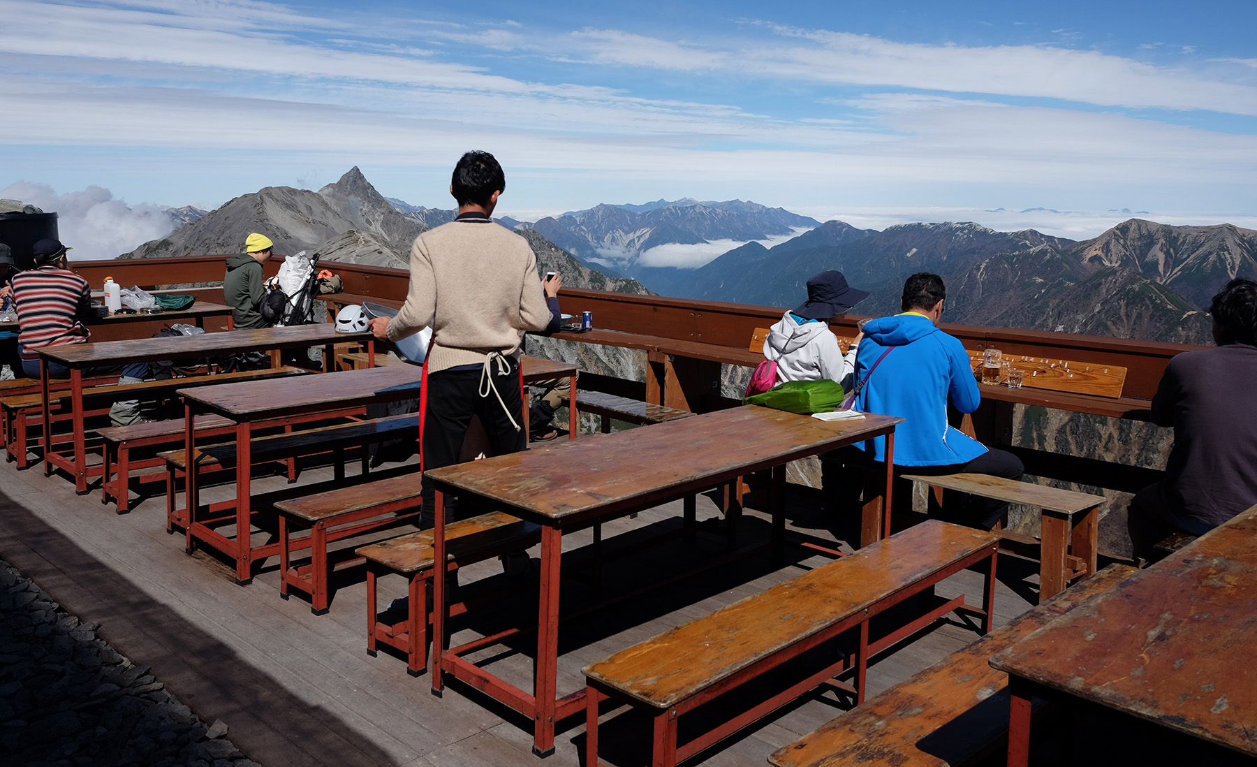
- Hut Stay & Resupply Category: Participants rest (30 minutes or more) and stay in huts, and resupply food.
- Hut Resupply Category: Participants resupply food and drinks in huts without resting.
- No Resupply Category: Participants do not rest or resupply food in huts, only replenishing water.
- Getting food or a place to sleep from others counts the same as using a hut.
- If you're in the Hut Resupply category, you can also grab gear sold at huts, like charging a battery or buying gas cans, but everything you carried must come back down with you.
- You may shop and resupply in towns or bus-accessible places like Kamikochi or Shin-Hotaka. Water refills are fine anywhere, even paid ones at huts.
- Carry all your gear yourself except the food and drinks you resupply. You can swap gear at places reachable by public transit.
- You can leave the course and resume from any trailhead later. Split your attempt into sections and go home in between if you like. Vehicle travel outside the course is fine, but make sure your GPS log eventually connects in one line. Your time is measured from your first start to your final finish.
- Sections you'd have to cover twice in one push only need to be logged once if splitting your attempt lets you pass them just once.
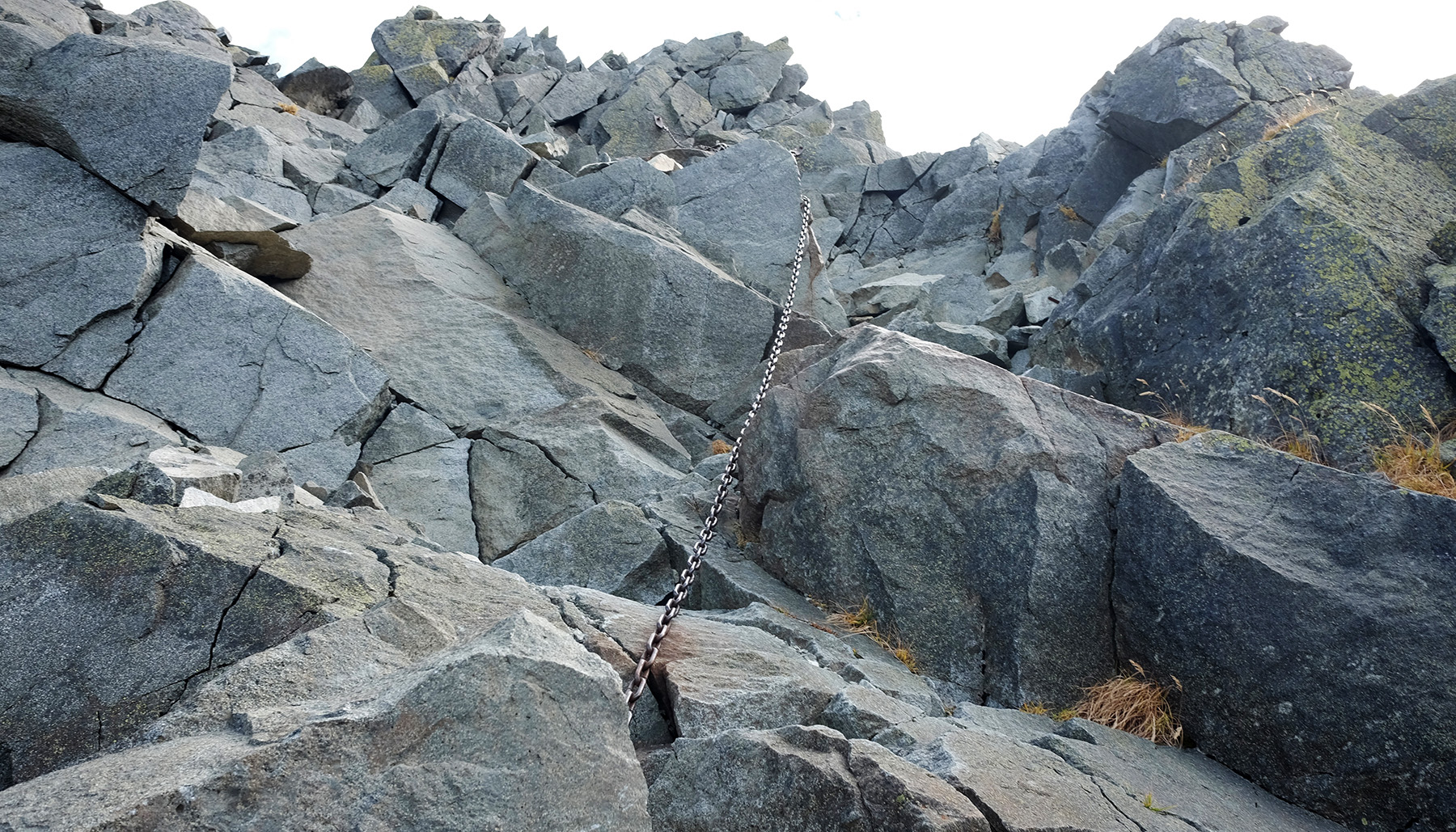
- This area is one of Japan's toughest mountain zones. Put safety first and avoid risky ridges in bad weather.
- Handle all the usual prep for a multi-day trek: gear selection, route and food planning, hut bookings, climbing plans, and insurance.
- This is a personal challenge. We'll watch over you and call for help if needed, but we can't compensate for accidents.
Model Course
As a reference, we present a model course that passes through all checkpoints.
As stated in the rules, as long as you visit every checkpoint and keep your track continuous, you don't have to follow this specific course.
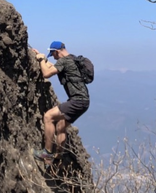
This course passes through the "Japan's Three Great Kirrettes": "Dai-Kiretto," "Hachimine-Kiretto," and "Kaerazu-no-Ken," which are extremely dangerous.
In case of bad weather or fatigue, avoid these difficult sections and consider staying in safe places or taking detours.
https://ja.ibuki.run/ev/8964704438288078582/
Distance: 245.2km
Total Elevation Gain: 20,522mD+
Trail Rate: 95.9%
Standard Course Time: 201 hours 34 minutes
Information
IBUKI STATION Podcast
We share the latest news and insights for the Great Northern Japanese Alps on our IBUKI STATION podcast. Tune in to stay updated!

Organizer: Great Trails Organizing Committee
Cooperation:
![]()
Contact:info@great-trails.jp